A Public Service Announcement
October 8, 2024
A Tuesday Newsday Classic
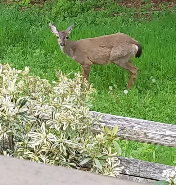
This week’s blog is really more of a public service announcement (PSA). Each year when I turn the calendar page to October, I know it is time once again to think about the very scary…. Cervidae. Or, as most people know the species, deer.
With approximately 21 million deer living in the United States, it should surprise no one that conflicts between people and deer will arise. Back to that in a moment. But first a little information on the Mule deer species, the most common Cervidae in the Pacific Northwest, as told by the Infallible Wikipedia:
“Deer are browsers. During the winter and early spring, they feed on Douglas fir, western red cedar, red huckleberry, salal, deer fern, and lichens growing on trees. Late spring to fall, they consume grasses, blackberries, apples, fireweed, pearly everlasting, forbs, salmonberry, salal, and maple. The mating or ‘rutting’ season occurs during November and early December. Bucks can be observed running back and forth across the roads in the pursuit of does. After the rut, the bucks tend to hide and rest, often nursing wounds. They suffer broken antlers, and have lost weight. They drop their antlers between January and March. Antlers on the forest floor provide a source of calcium and other nutrients to other forest inhabitants. Bucks regrow their antlers beginning in April through to August.
(snip)
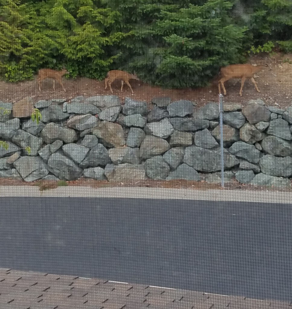
At dawn, dusk, and moonlit nights, deer are seen browsing on the roadside. Wooded areas with forests on both sides of the road and open, grassy areas, i.e. golf courses, attract deer. Caution when driving is prudent because often as one deer crosses, another one or two follow.”
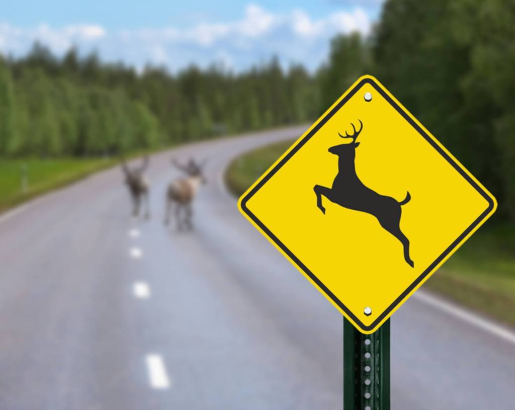
The last line brings me back to the PSA. From October through December you are much more likely to see deer near or on the road and are much more likely to hit one with your car. We can conclude that the need to forage farther and farther for food to sustain them through the winter, combined with the urge to mate, increases their interactions with people.
At the ripe old age of 22 I learned the hard way a universal truth about deer. Driving home from Tacoma to the small town of Eatonville (population 1005) one early October night in my trusty Ford Pinto, a deer leaped out in front of me. I braked and barely missed the animal… then I made a classic mistake. Thinking the danger was past, I put my foot on the gas and sped up. Yep. I hit the second deer.
Over the years I’ve encountered many deer on the roads and have been known to freak out a bit when driving, especially at dusk. I’m constantly watching the sides of the highway looking for the critters.
My concern is justified. About 7 years later, I hit another deer one morning in spring while on my way to work. Yes, I’m paranoid.
My most illustrative encounter occurred on a late September evening while driving a group of teenage girls to a weekend camp out on Hood Canal. It was a Friday and by the time we had the group organized, stopped for fast food, and then crawled our way through the Seattle/Tacoma metro traffic, it was dark.
As we made our way along state Highway 106 and approached Twanoh State Park, the young woman who was riding shotgun asked why I was driving so slowly.
“I’m looking for deer,” I replied, then continued, “They are active this time of year and day.”
I then proceeded to tell her about my two deer related accidents and issued the following warning:
“So if you are ever driving and a deer jumps out in front of you, STOP, because they always travel in pairs.”
“Always?” she questioned.
“Pretty much always,” I replied.
And then, not three minutes later, it happened.
From my left a deer bounded across the road in front of the van. I hit the brakes and stopped. A moment later the second deer crossed exactly where the car would have been had I not stopped.
“How did you do that?” she asked, a look of awe on her face in the low glow of the dashboard lights.
“It’s my deer karma,” I replied.
Yes, deer karma is a thing. I have another friend who is certain that I attract the critters. On a different road trip a few years earlier, I was a passenger in her car, driving from Moscow, Idaho, to Seattle one summer night. It was late June and we had been talking about my deer encounters. After hearing my stories, the poor woman was panicked, worried about ‘when’ (not if!) some random buck or doe would pop up in front of us.
For 240 miles everything was fine and I kept saying that I was not capable of conjuring up random deer… that was until the very top of Snoqualmie Pass. Just as the car swept around the last curve to the summit, smack dab in the middle lane of Interstate 90, was a deer. Just standing there as though waiting for me.
“I knew it! I knew it!” she exclaimed. “It’s you. They’re your totem animal.”
As for me I had no explanation. I’d never before seen a deer standing in the middle of Snoqualmie Pass and never have again. Yet, there the deer was, confirming to her that I had some mystical ability to conjure up my patronus animal, the mule deer.
Personally, I think it would be much easier to have a dog, a cat, or a chipmunk, for my totem animal. Or a sloth. A sloth would be nice as it would never jump out in front of me while driving.
The links:


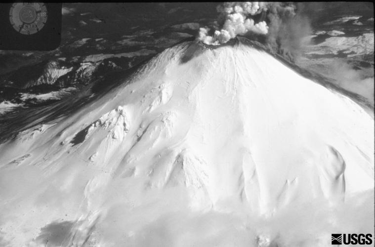 It was on March 27, 1980, that the first plumes of steam escaped from Mt. St. Helen’s. Just over seven weeks later, the mountain experienced a 5.1 earthquake which caused the north side of the volcano to slide away and triggered the largest debris avalanche in recorded US history.
 It was not until the April 23rd issue when I reported the first dusting of ash in Eatonville. Less than a month later the mountain blew.